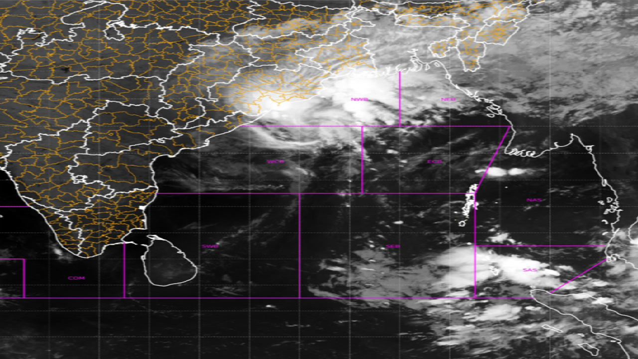
The latest satellite imagery indicates the landfall process of cyclone Akvan has commenced as the outer rain cloud band entered into the land.
Further, the landfall process will continue during next 3 hours. The cyclone has moved North-northwestwards with a speed of 21 kmph during past 6 hours.
It now lies centered at 80 km east of KALINGAPATNAM (Andhra Pradesh) and 130 km south of GOPALPUR (Odisha). However the complete circulation will enter around forenoon of 20th November, 2026.
Further, the Severe Cyclonic Storm Akvan over the westcentral Bay of Bengal moved north-northwestwards with the speed of 21 kmph during past 06 hours, weakened into a Cyclonic Storm.
It is likely to continue to move north-northwestward and cross North Andhra Pradesh and South Odisha coasts close to Gopalpur, by forenoon of 20th November, 2026 with the maximum sustained wind speed of 70-80 kmph gusting to 90 kmph.
Latest Satellite imagery indicates the Land interaction commenced as the sheared cloud mass associated with the Cyclonic Storm Akvan entered into north Andhra Pradesh-south Odisha coasts.
The system is under continuous surveillance of the Doppler Weather Radar at Visakhapatnam and Gopalpur.
Landfall Process
Here, let us understand what is Cyclone Landfall and how it occurs.
A cyclone landfall occurs when the centre of a tropical cyclone crosses the coastline and moves over land. During landfall, coastal areas may experience:
Strong Winds – Powerful winds can damage buildings, trees and infrastructure.
Storm Surge – Rising seawater can inundate coastal regions.
Heavy Rainfall – Intense rainfall can trigger flooding and waterlogging.
Coastal Erosion – High waves can damage beaches and shorelines.
Stay Alert and Stay Informed!